
The United States has one of the most diverse climates of any country in the world — ranging from Arctic tundra in Alaska to tropical rainforests in Hawaii, and from humid subtropical conditions in the Southeast to arid desert in the Southwest. Our collection of 10 free printable US climate maps covers all major climate zones and regions across the country.
List of Climate Map United States :
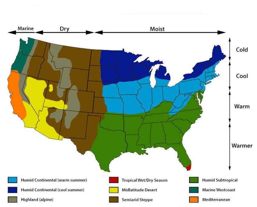
1. U.S Climate Map:

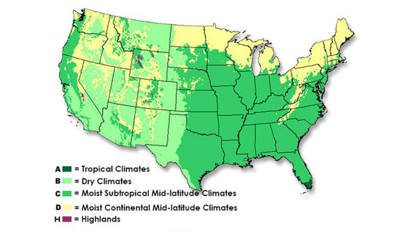
2. U.S Climate Zone Map:
3. U.S Climate Change Map:
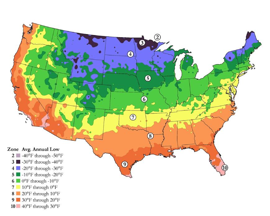
4. U.S Climate Temperature Map:

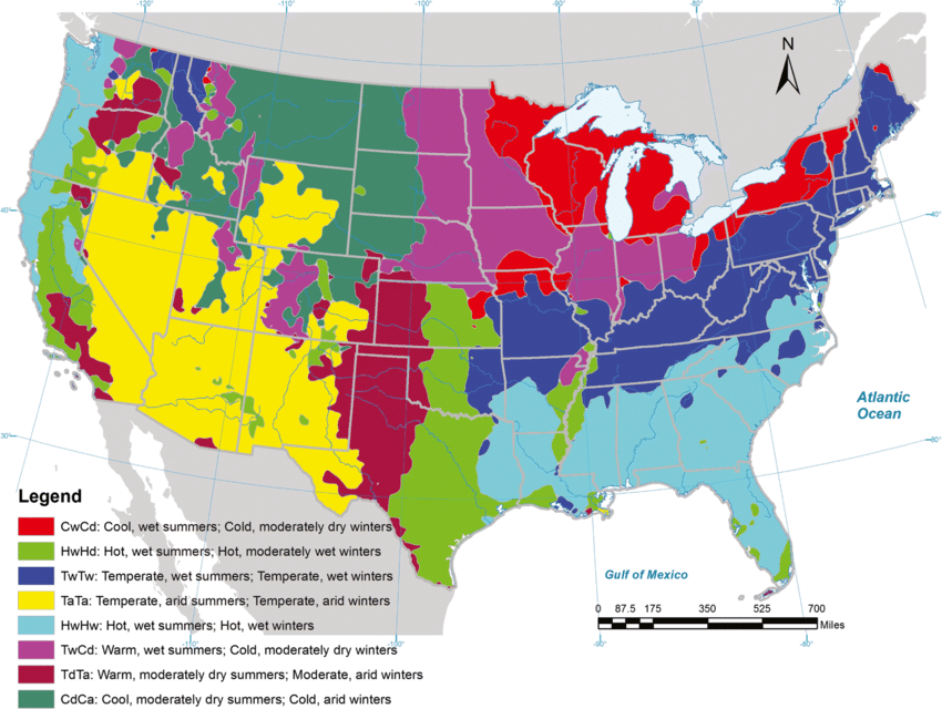
5. Climate Map USA :
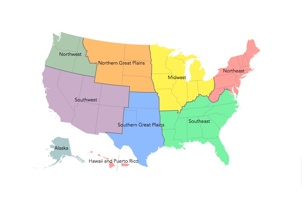
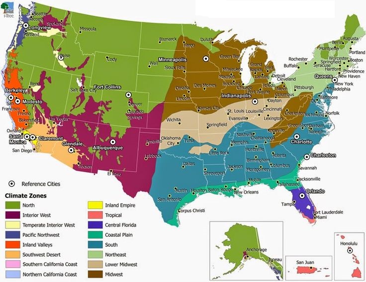
6. U.S Climate Regions Map:
7. Printable US Climate Map:

8. U.S Climate Zone Location Map:
9. U.S Climate Annual Map:
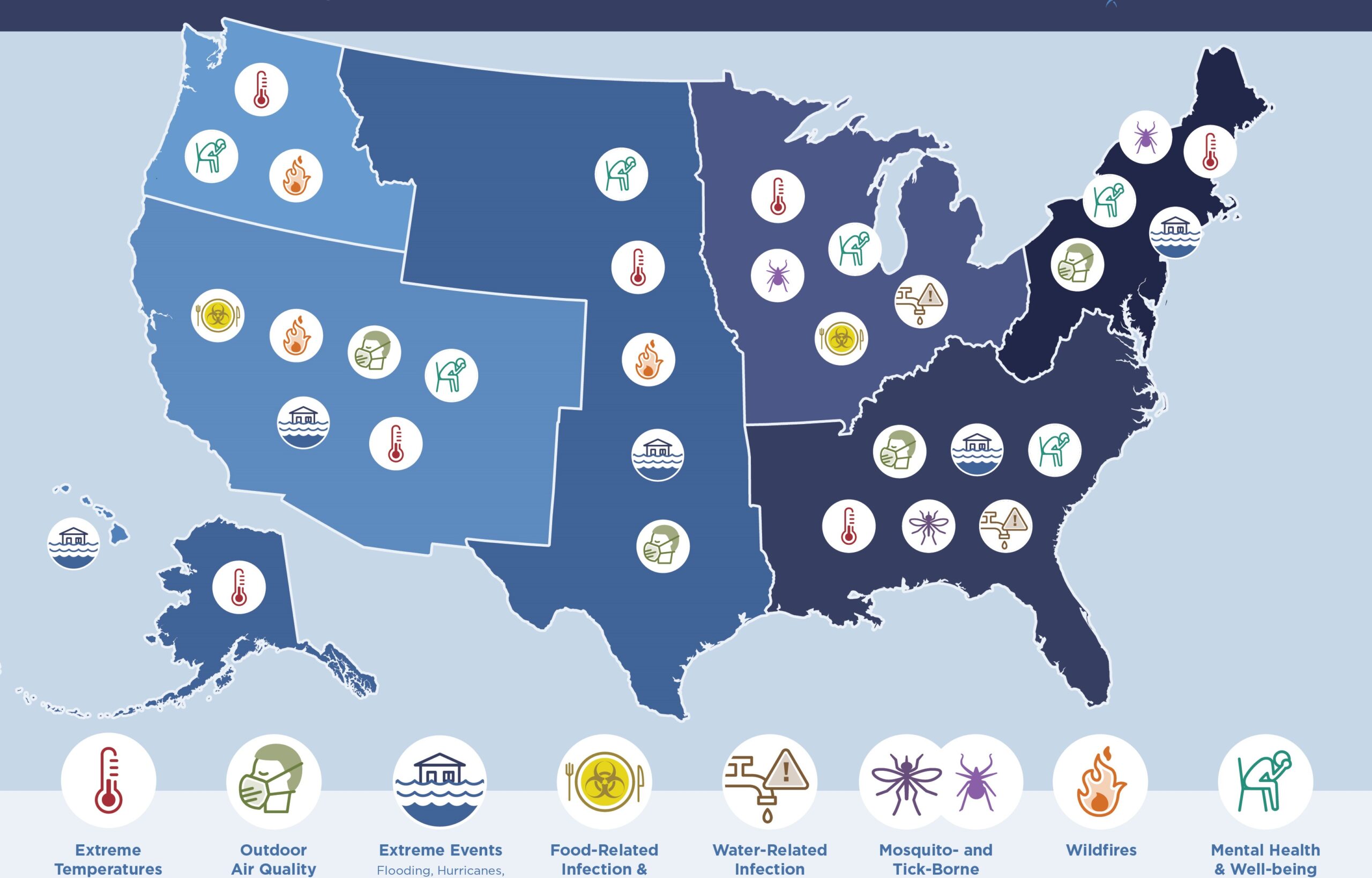
10. U.S Climate Affects Health Map:
Above we have shown 10 ways of climate map of USA for you, with the help of which you can know about the climate of all the regions of America. For your information, let us tell you that the climate of the United States varies due to the change in latitude and many geographical features. Which you can see in the image 1st and 5th.
This type of map is needed by most of the researchers for their research so that they can find out how the climate of that area is. The 50 states of the United States have different climatic conditions such as some hot, cold, snowy, and rainy. Latitude plays an important role in defining the climatic conditions of an area.
We have shown all types of USA map climate in our list according to your condition, which you can use according to your needs. The American climate has been divided into 9 parts by the researcher. Which you can see below:
- Humid Continental (Hot Summer): Found in the Midwest and Northeast — states like Illinois, Indiana, and Ohio. Hot summers and cold winters with year-round rainfall.
- Humid Continental (Cool Summer): Northern states like Minnesota, Wisconsin, and Maine. Shorter, cooler summers and very cold winters.
- Highland (Alpine): Mountain regions of Colorado, Wyoming, and Montana. Cool temperatures year-round with heavy snowfall.
- Tropical Wet/Dry Season: Southern Florida and Hawaii. Hot and humid with distinct wet and dry seasons.
- Mid-Latitudinal Desert: Nevada, Utah, Arizona interior. Very low rainfall, extreme heat in summer.
- Semi-Arid Stepp: Great Plains states — Kansas, Nebraska, Oklahoma. Low rainfall, hot summers, cold winters.
- Humid Subtropical: Southeast states — Georgia, Alabama, Mississippi, Louisiana. Hot, humid summers, mild winters, and high rainfall.
- Marine West Coast: Pacific Northwest — Oregon, Washington. Mild temperatures, high rainfall, cool summers.
- Interior: Inland western states — Idaho, Wyoming. Continental climate with temperature extremes.
For your needs, we have also included the temperature map in our list. Maybe you need it, you can use it in your research, we have shown it on number 4. If you want to get more information about it, then take a look at our temperature maps article.
This map of USA climate is free of cost for you. You do not need to pay anything to download them; you just have to click on the PDF button. We have put it at the bottom of each image. So that you can download the image of your choice in PDF format. And the map of the US climate is also printable; you can easily print it using a printer.
If we have not defined any map related to US map climate or have left it out for some reason, then you can contact us through a comment or email. With which we will be able to define that map in front of you as soon as possible.
Frequently Asked Questions
Q1: How many climate zones does the USA have?
The United States has 9 major climate zones — Humid Continental (hot & cool summer), Highland, Tropical, Desert, Semi-Arid Steppe, Humid Subtropical, Marine West Coast, and Interior. This makes the USA one of the most climatically diverse countries in the world.
Q2: What is the most common climate in the USA?
The Humid Subtropical climate is the most widespread in the continental USA, covering much of the southeastern states, including Florida, Georgia, Alabama, Mississippi, and Louisiana.
Q3: Which US state has the most extreme climate?
Alaska has the most extreme climate, ranging from Arctic conditions in the north to subarctic and even some temperate zones in the south. In the contiguous USA, Arizona experiences the most extreme heat.
Q4: Can I download these climate maps for free?
Yes, all 10 climate maps are completely free. Click the PDF button under any map to download it instantly.


