
We all know that the United States of America is counted among the largest countries in the world, which are known by different names such as American Samoa, Guam, Northern Mariana Islands, Puerto Rico, and the US. The Virgin Islands. If you are searching for a US territories map, then you are in the right place because we have made a list of territories map for you which you can see below:
All U.S Territories Map List :
1. U.S Territory Map by President:

2. U.S States and Territories Map:

3. Territories Map of U.S.A:
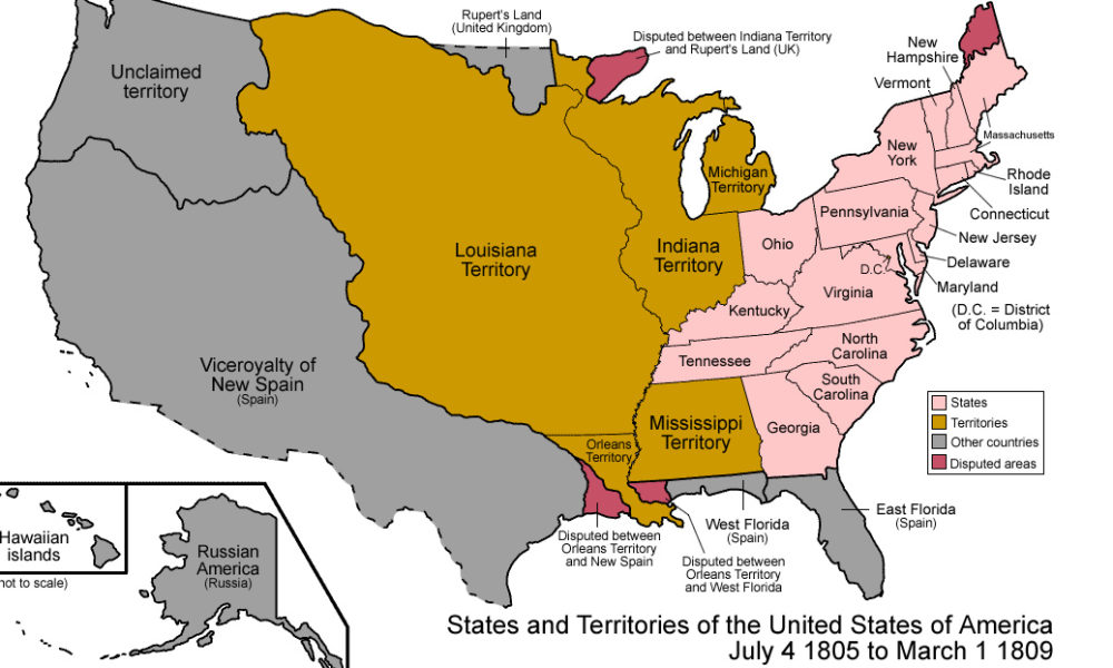
4. U.S Territory Map of 1805 to 1809:
5. U.S Territory on World Map:

6. U.S Territory Map of Last Year:

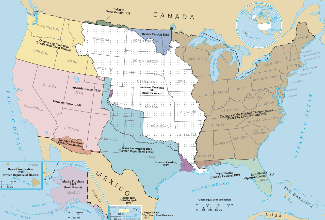
7. U.S Territory Map of 1783 to 1898:

All 5 US Territories — Quick Overview
| Territory | Location | Year | Population | Area |
| Puerto Rico | Caribbean Sea | 1898 | ~3.2 million | 3,515 sq mi |
| Guam | Western Pacific | 1898 | ~168,000 | 210 sq mi |
| US Virgin Islands | Caribbean Sea | 1917 | ~102,000 | 133 sq mi |
| American Samoa | South Pacific | 1900 | ~55,000 | 77 sq mi |
|
Northern Mariana Islands
|
Western Pacific | 1976 | ~54,000 | 179 sq mi |
The territories of the United States are subnational administrative divisions overseen by the U.S. The federal government does. You cannot be saying that these states and people living in these areas do not have state recognition, the President does not have the right to vote in the general elections. Different American territories differ from American states and Native American tribes in this sense. But these people can vote in US presidential elections. We will also give you information about these territories so that you can be of some help, for which you have come to our website.
American Samoa is located in the South Pacific Ocean, to the southeast of the independent state of Samoa. It has been a member of the Pacific Community since 1983. American Samoa is known for having the highest rate of military recruitment of any US state or territory. American Samoa became a US territory in 1900. It has a population of about 55000. This area covers 77 square miles of land in the US.
Now let’s talk about Guam. It is an organized, unincorporated territory of the United States in the Micronesia subregion of the western Pacific Ocean. It became a US territory in 1898. As of 2021, there are approximately 168,801 residents living in Guam. This area is spread over 210 square miles. And it is also said that Chamoru people settled this island about 3,500 years ago. During the Spanish–American War, the United States occupied Guam on June 21, 1898.
The Northern Mariana Islands are an unincorporated territory of the United States and the Commonwealth of Nations, consisting of 14 islands. It was introduced in the U.S. in 1976 and became popular. It covers approximately 179 square miles of the landmass of the U.S. The Northern Mariana Islands are home to 54,000 inhabitants. The Northern Mariana Islands were one of the islands in remote Oceania inhabited by humans. Its most important thing is that it does not allow non-native residents to own the land. They can only take it on lease.
Puerto Rico is the fourth US territory, a Caribbean island, and an unincorporated territory of the United States. Which is located in the northeast Caribbean Sea to the southeast. In 1898, it became a territory of the United States. It is inhabited by about 35 lakhs. It covers a vast area of land. It is spread over 3515 square miles of the U.S.
The last territory of the United States Virgin Islands. It is also called a group of Caribbean islands. In 1917, it became a US territory, which is spread over 133 square miles. The main islands of the US Virgin Islands are St. Croix, St. John, and St. Thomas. About 102,951 people are residing in these islands.
Mostly, the American territories map is used for school and college projects, whereby such projects are given by a teacher. Many people also need this type of map, who are fond of knowing about the history associated with the territories’ maps, they demand such maps.
All the maps shown above are free of cost. You do not need to pay any money to download these maps. And it is also very easy to download it, you just have to click on the PDF button, which will open a new tab, you can easily download these maps to your computer or smartphone according to your condition.


