
In today’s era, there are people who love nature very much, they love to plant trees. If you are also one of them. So we have special information related to this for you. By which you can increase your knowledge. That’s how you can plant trees and grow them in a better way. For this, you need a US hardiness zone map. You have to see the list which is shown below through the list.
Hardiness Zone Map US List :
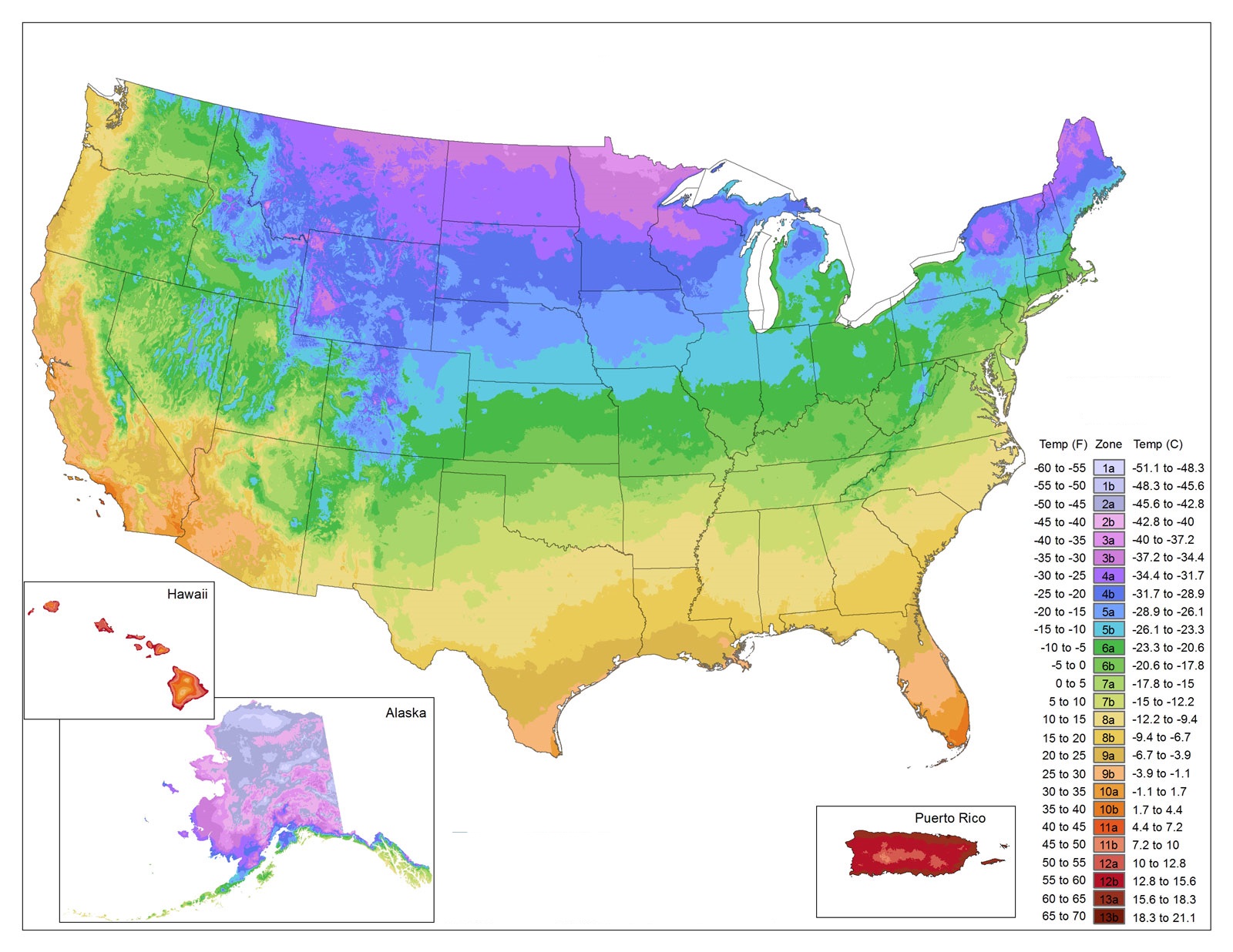
1. U.S Hardiness Zone Map:
2. U.S Hardiness Growing Zone Map:

3. U.S Hardiness Zone South Western Map:

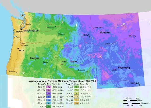
4. U.S Hardiness Zone North Western Map:
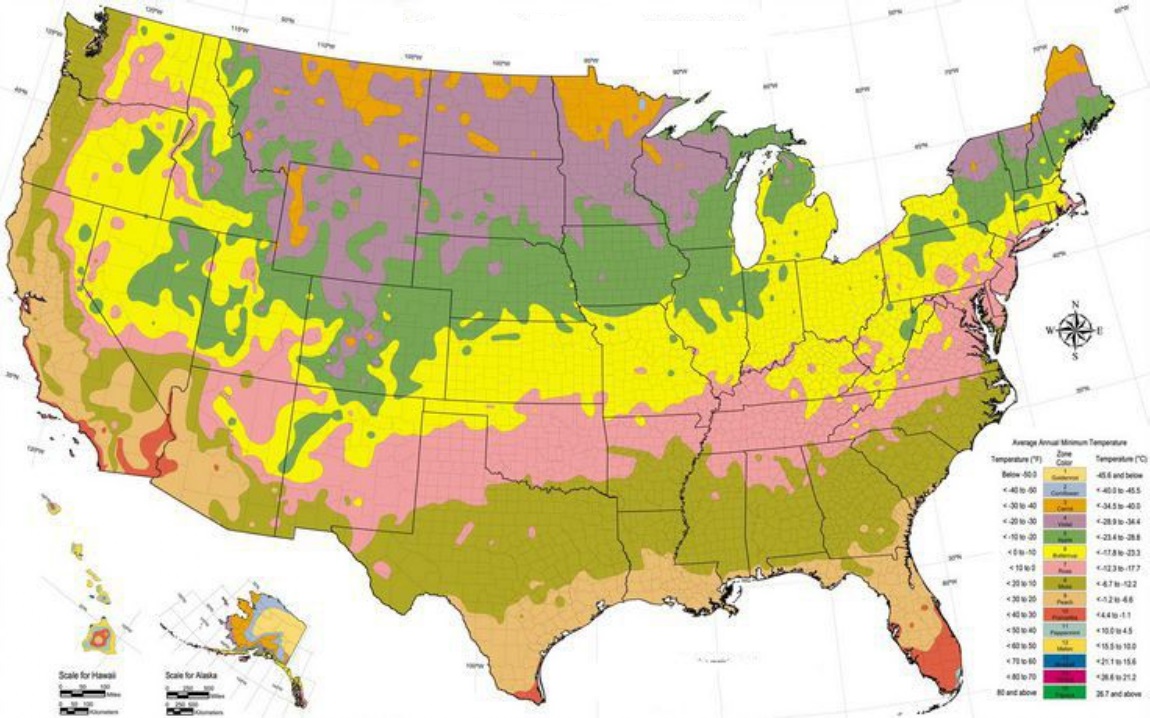
5. Hardiness Map USA :
6. U.S Hardiness Zone Map White & Black:

7. Printable US Hardiness Zone Map:

8. U.S Hardiness Zone North Eastern Map:

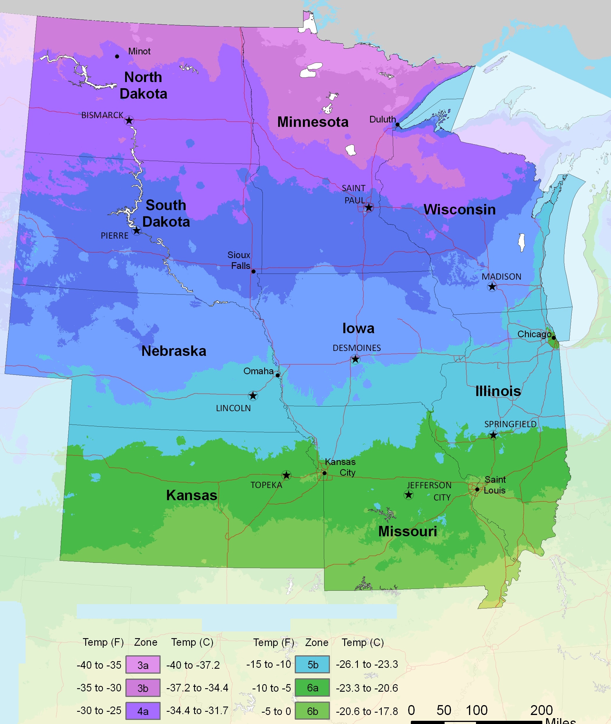
9. U.S Hardiness Zone North Central Map:
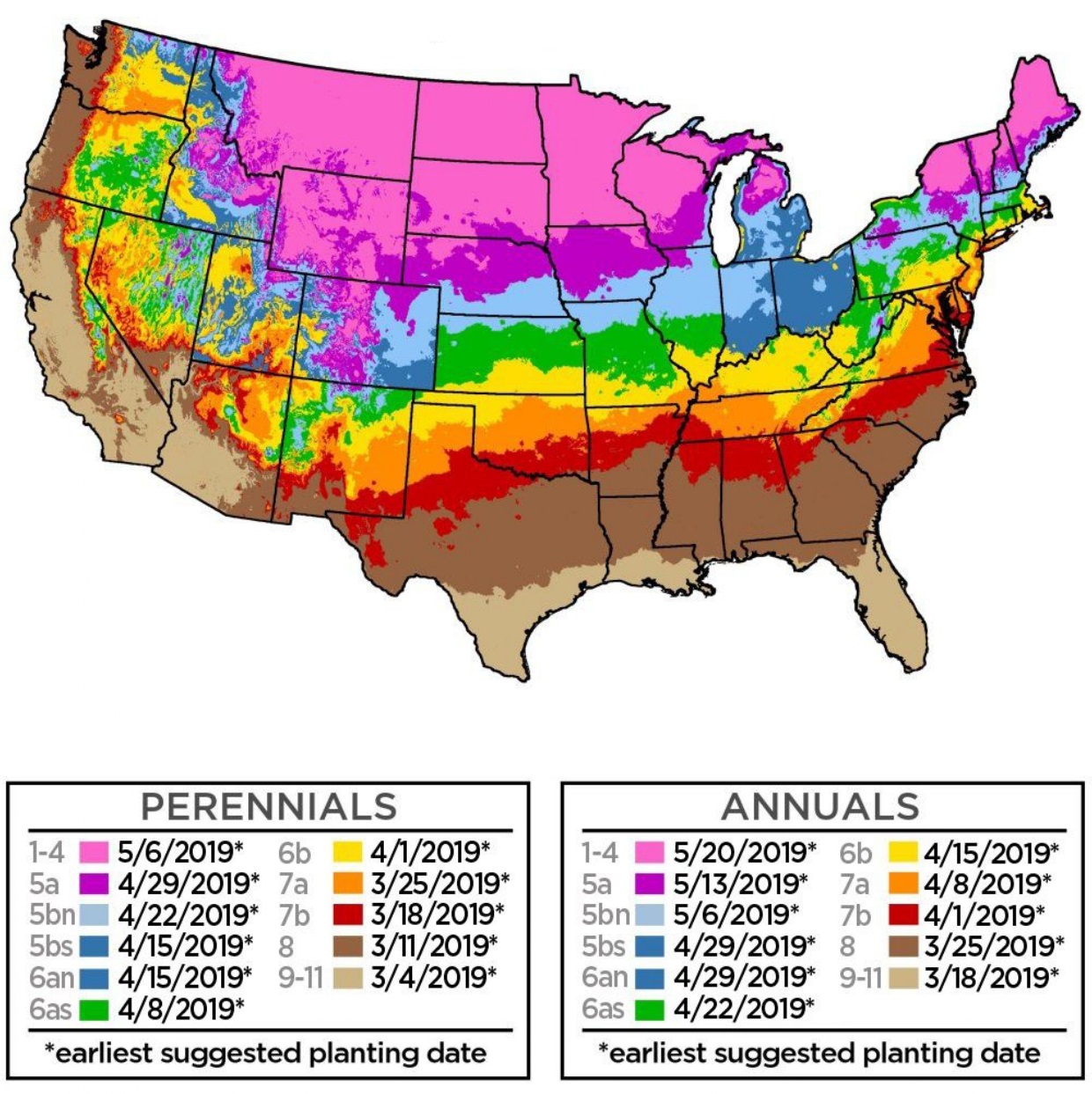
10. U.S Hardiness Zone Annual Map:
We have defined 10 methods of hardiness zone map USA for you above. With the help of this, you can improve the area suitable for planting and cultivation. And can also find out where we should plant. So that the plants can develop properly. This is possible only if you work properly on our given maps.
For your information, let us tell you that the hardiness zone is compared with the geographical area. It is defined as the annual minimum temperature on a regular average, which is very important for the growth of plants. The United States Department of Agriculture (USDA) has developed a widely used system as a rough guide on landscaping and gardening.
This defines 13 regions of minimum temperature. This system has been adapted in various forms by other countries. For example, a plant might be described as “hardy to zone 10.” This means that the plant can withstand minimum temperatures of 30 °F (−1.1 °C) to 40 °F (4.4 °C). This is shown on the USDA scale, whose report you can see in the list of hardiness zone map of US.
This will let us know which plant you should grow in which area. Because everyone knows the matter. Plant growth largely depends on the area and the fertilizer capacity of the land. If the fertilizer capacity is less than, the plant will not grow. For this, you can take the help of our second image.
USDA Plant Hardiness Zones Explained
The USDA Plant Hardiness Zone Map is the standard tool by which gardeners and growers determine which perennial plants are most likely to thrive at their location. The map is based on the average annual extreme minimum winter temperature, displayed as 10-degree F zones.
All 13 USDA Hardiness Zones:
| Zone | Minimum Temperature | Best For |
| Zone 1 | Below -60°F | Alaska wilderness only |
| Zone 2 | -50°F to -40°F | Northern Alaska |
| Zone 3 | -40°F to -30°F |
Northern Minnesota, Montana
|
| Zone 4 | -30°F to -20°F |
Northern states, Great Plains
|
| Zone 5 | -20°F to -10°F | Midwest, New England |
| Zone 6 | -10°F to 0°F | Mid-Atlantic, Pacific NW |
| Zone 7 | 0°F to 10°F | Virginia, North Carolina |
| Zone 8 | 10°F to 20°F | Pacific Coast, Southeast |
| Zone 9 | 20°F to 30°F | California, Gulf Coast |
| Zone 10 | 30°F to 40°F | Southern Florida, Hawaii |
| Zone 11 | 40°F to 50°F | Hawaii, Puerto Rico |
| Zone 12 | 50°F to 60°F | Hawaii only |
| Zone 13 | 60°F to 70°F | Hawaii (tropical) |
Most Common Zones: Zone 6 covers a large portion of the United States with average minimum winter temperatures between -10 and 0 degrees F. Most of the continental US falls within Zones 4-9.
As easily as you are seeing all these hardy zones maps of the USA, you can easily download them. That too without paying any. You have to click on the PDF button. A new window will open. Then from there, you can download or print any USA hardness map.
Frequently Asked Questions
Q1: What is a plant hardiness zone?
A hardiness zone is a geographic area defined by its average annual minimum temperature — an important factor for the survival of many plants. The USDA system defines 13 zones based on long-term average annual extreme minimum temperatures.
Q2: How many hardiness zones does the USA have?
The USDA Plant Hardiness Zone Map divides the US into 13 zones, each covering a 10°F range, with subzones (a/b) representing 5°F differences.
Q3: Which US states are in Zone 9?
Zone 9 covers much of California’s Central Valley, coastal areas of Oregon and Washington, southern Texas, Louisiana, and parts of Florida. Average minimum winter temperatures in Zone 9 are between 20°F and 30°F.
Q4: Can I download these hardiness zone maps for free?
Yes, all maps are completely free. Click the PDF button under any map to download instantly.


