
The climate of the United States is generally temperate. However, it is tropical in Hawaii and Florida. If we talk about USA latitude and longitude, then the US lat-long is 38º 00′ N and 97º 00′ W respectively. It includes 50 states. If you are looking for a US latitude map, then you can see the image attached below. That will end your search. And you can use them in your projects and research. All maps are absolutely free of cost for you.
Latitude Longitude Map USA Collections :
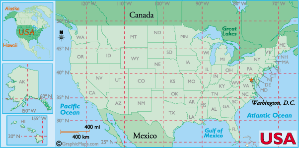
1. U.S Latitude Map:
2. U.S Map with Latitude Lines:
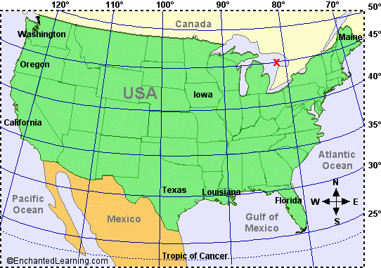
3. U.S Longitude Map :

4. U.S Map with Latitude and Longitude:

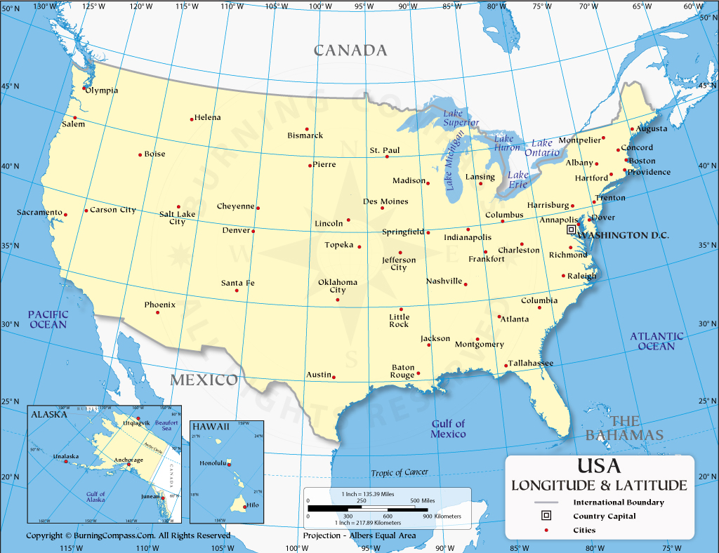
5. U.S Latitude and Longitude Map with Cities:
6. U.S Latitude and Longitude Blank Map:

We have defined the above 6 types of US latitude maps and longitude maps, which you can take according to your needs. For your information, let us tell you that the climate of the United States is generally temperate. However, it is tropical in Hawaii and Florida. We explicitly refer to the US latitude and longitude angles through maps, which are measured in degrees (1 degree = 60-minute arc) that tell you the exact location of a country, city, etc. on the map. You will be able to know the latitude and longitude along with the state capital, county seats, state boundaries, and country boundaries by clicking on these maps.
Some people need a US map with latitude and longitude for their project, which they find on Google. If you have come to our website and you need more maps related to them or more. So your search related to your maps from our website ends. Because we have placed a map of every type on our website, which you can use according to your needs.
It is very easy to download all these maps because we have put a PDF button at the bottom of each image. You can download these maps to your smartphone or computer by clicking on that button. All these US maps with latitude and longitude are printable; you can print out the map you need through the printer. You do not have to pay any kind to download all these maps, all of them are absolutely free for you. Which is not on any other website.
Key US Latitude and Longitude Facts
USA Geographic Coordinates:
- Center of USA: 38°N, 97°W
- Northernmost Point: Point Barrow, Alaska (71.4°N)
- Southernmost Point: Ka Lae, Hawaii (18.9°N)
- Easternmost Point: West Quoddy Head, Maine (66.9°W)
- Westernmost Point: Cape Wrangell, Alaska (172.5°E)
Major US Cities — Coordinates:
- New York City: 40.7°N, 74.0°W
- Los Angeles: 34.0°N, 118.2°W
- Chicago: 41.8°N, 87.6°W
- Houston: 29.7°N, 95.3°W
- Washington D.C.: 38.9°N, 77.0°W
What is the difference between latitude and longitude?
Latitude lines run horizontally east to west and measure how far north or south a location is from the equator (0°). Longitude lines run vertically north to south and measure how far east or west a location is from the Prime Meridian (0°). Together, they pinpoint any exact location on Earth.
I think you might have liked my long lat map of the US article. Share this with those who need it if we have missed a US latitude and longitude map. The one you need is not in our USA map latitude list. You tell us about it so that we can define that map in front of you as soon as possible.
Frequently Asked Questions
Q1: What is the latitude and longitude of the USA?
The geographic center of the United States is located at approximately 38°N latitude and 97°W longitude — in Smith County, Kansas. The contiguous USA spans from 24°N to 49°N latitude and 67°W to 125°W longitude.
Q2: What is the difference between latitude and longitude?
Latitude measures north-south position from the equator (0° to 90°). Longitude measures east-west position from the Prime Meridian (0° to 180°). Together, they create a grid system to locate any point on Earth.
Q3: Which map shows both latitude and longitude of the USA?
Map #4 (US Map with Latitude and Longitude) shows both coordinate systems together — ideal for geography projects. Map #5 adds major city locations to the coordinate grid.
Q4: Can I download these lat long maps for free?
Yes, all 6 maps are completely free. Click the PDF button under any map to download it.


