
There are many people in the world who like to travel to famous places. If you are a US citizen and are looking for such a place, then you are at the right place. Take a look at our article related to Desert once. You will get a serene atmosphere here which will give you a different feel of the place. We have put in front of you a list of US deserts map. With the help of this, you can enjoy those places to the fullest. There are 4 such deserts in America that are very famous, which we will discuss below.
Collection of Desert US Map :
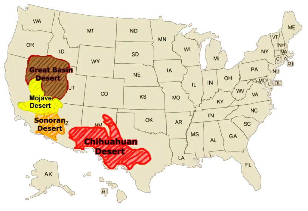
1. U.S Desert Map:

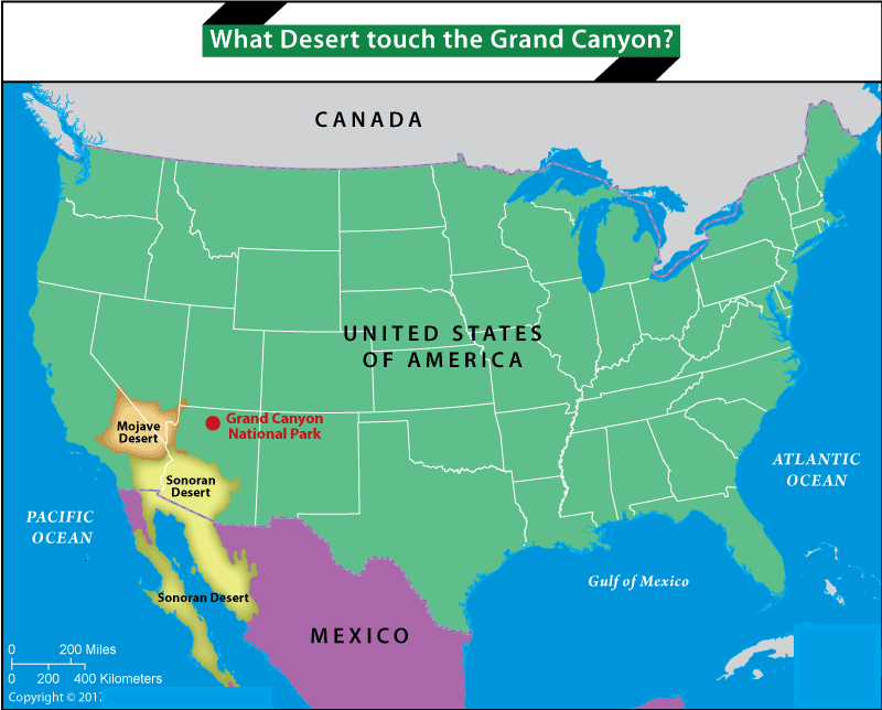
2. U.S Desert Map With State:
3. U.S Desert Unlabeled Map:
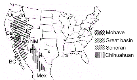
4. U.S Desert Map Black & White:
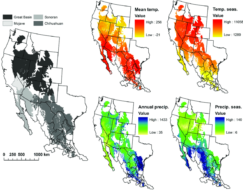
5. U.S Desert Regions Map:
We have shown the above 5 types of maps according to your needs. You can use it according to you. For your information, let us tell you that there are 4 deserts in the United States of America: the Great Basin Desert, the Mojave Desert, the Sonoran Desert, and the Chihuahuan Desert. People are aware of all these deserts. We are sharing some information related to them with you.
Great Basin Desert
This desert is the largest desert area in North America. covering southeast Oregon, a small part of northeast California, most of west Utah, part of southeast Idaho, and most of Nevada. It is a cold desert due to its northern location and relatively high altitude – most of the land is above 1200 m (4000 ft), but is in the ‘rain shadow’ of high mountain ranges.
Most of the precipitation falls in the form of snowfall in winter, but not all of it melts into the ground as some of it evaporates in the spring. Vegetation is very similar in large areas of this desert. The entire land is characterized by long, thin, parallel mountain ranges running north-south, separated by broad valleys, often with dry lake beds (playas) or salt valleys. Some rivers flow inward, and have no outlet to the sea; Their water eventually either sinks beneath the ground or evaporates.
Mojave Desert
This desert occurs further south and covers the southern part of Nevada (150 miles) and part of California (Ca), but its elements extend into Arizona (AZ), where it merges with the Sonoran Desert. Again, it is classified as a cold desert due to its low winter temperatures. Precipitation occurs in winter, usually in the form of rain but sometimes in the form of snow at higher altitudes.
The characteristics of the Mohave Desert are difficult to define because of the remarkable variation in topography, soil, and climate. For example, the northern section is composed of low-growing shrubs similar to the Great Basin Desert, while the southern section blends into the Sonoran Desert, with extensive tracts of creosote bush. Las Vegas is a major city in the region, which includes some of California’s most famous parks, such as Death Valley, the northern half of the Mojave, Anza Borrego, and Joshua Tree, as well as some lesser-known locations such as the Mojave Trails National Monument, Pinnacles National Natural Landmark, Rainbow Basin, Red Rock Canyon, a long stretch of former Route 66 and Saddleback Butte.
Sonoran Desert
This desert covers the southern part of Arizona and part of California, but extends south into the mainland of Mexico and the extended Isthmus of the state of Baja California (BC) in Mexico. It has vast flat plains and abundant cacti, especially the giant saguaro, which reaches the highest elevations in Arizona. Desert, between 1,500 and 3,500 feet.
The desert itself is divided into subregions, including the Colorado and Yuma Deserts of California, the Yuma Desert of far southwest Arizona, and the Arizona Desert further east. It runs a long way south into Mexico, about 500 miles on the east side of the Gulf of California. But the west-facing slopes of the peninsula receive moisture-laden air from the Pacific Ocean and have some distinctly lush vegetation, including epiphytic plants that obtain moisture from ocean mist.
Chihuahuan Desert:
This desert occupies part of the extreme west of Texas (TX) and New Mexico (NM), but the largest part of this desert occurs in mainland Mexico. Summer rainfall in this desert region comes from the Gulf of Mexico – usually about 20–30 cm per year. The soil in much of this desert is derived from calcareous rocks and thus has a relatively high pH. The Chihuahuan Desert is also located at relatively high altitudes (usually around 1200 m, or 4000 ft) and thus has cold winters with occasional frosts, but hot summers.
The combination of relatively high rainfall, calcareous soils, and cool winter temperatures favors the growth of grasses, yuccas, and agaves. And most of the rain falls during the summer storm season. Cacti are still plentiful but generally smaller than in the West; Instead, the predominant plants are yucca and agave, although even then, as is the case with many other desert regions, large areas consist only of ubiquitous creosote shrubs and mesquite trees. El Paso is the largest city, while the other major settlements are Las Cruces, Roswell, and Pecos.
You must have read the information related to your 4 deserts. We have already defined the image of the maps associated with the above. You can use these map of US deserts in your project or research. All these maps are printable. Let us tell you that you do not have to pay any payment to download these maps; all these maps are free of cost for you. You can download in one click to your computer or smartphone. You have to click on the BS PDF button. Which you will find at the bottom of each image. You can download the image you want to download.
Frequently Asked Questions
Q1: How many deserts are in the USA?
There are 4 major deserts in the United States — the Great Basin Desert, the Mojave Desert, the Sonoran Desert, and the Chihuahuan Desert. All four are located in the western and southwestern parts of the country.
Q2: What is the largest desert in the USA?
The Great Basin Desert is the largest in the United States, covering most of Nevada, parts of Utah, Oregon, Idaho, and California. It is also the largest desert in North America.
Q3: Which US desert is the hottest?
The Mojave Desert is the hottest in the United States. Death Valley, located within the Mojave Desert in California, holds the record for the highest temperature ever recorded on Earth at 134°F (57°C).
Q4: Can I download these desert maps for free?
Yes, all 5 desert maps are completely free. Click the PDF button under any map to download it instantly to your device.


