
Presidential election maps of the United States show how each state voted in a given election, with red states voting Republican and blue states voting Democratic. Our collection of 8 free printable US election maps includes historical maps from 2016 and 2020, state-wise maps, county-level maps, and blank maps for prediction activities.
United States Election Map Collections :
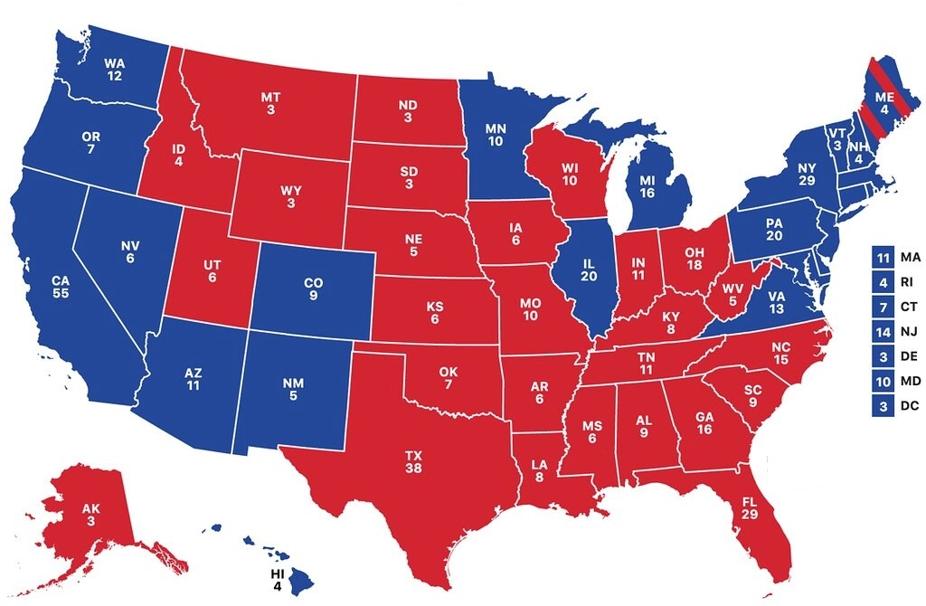
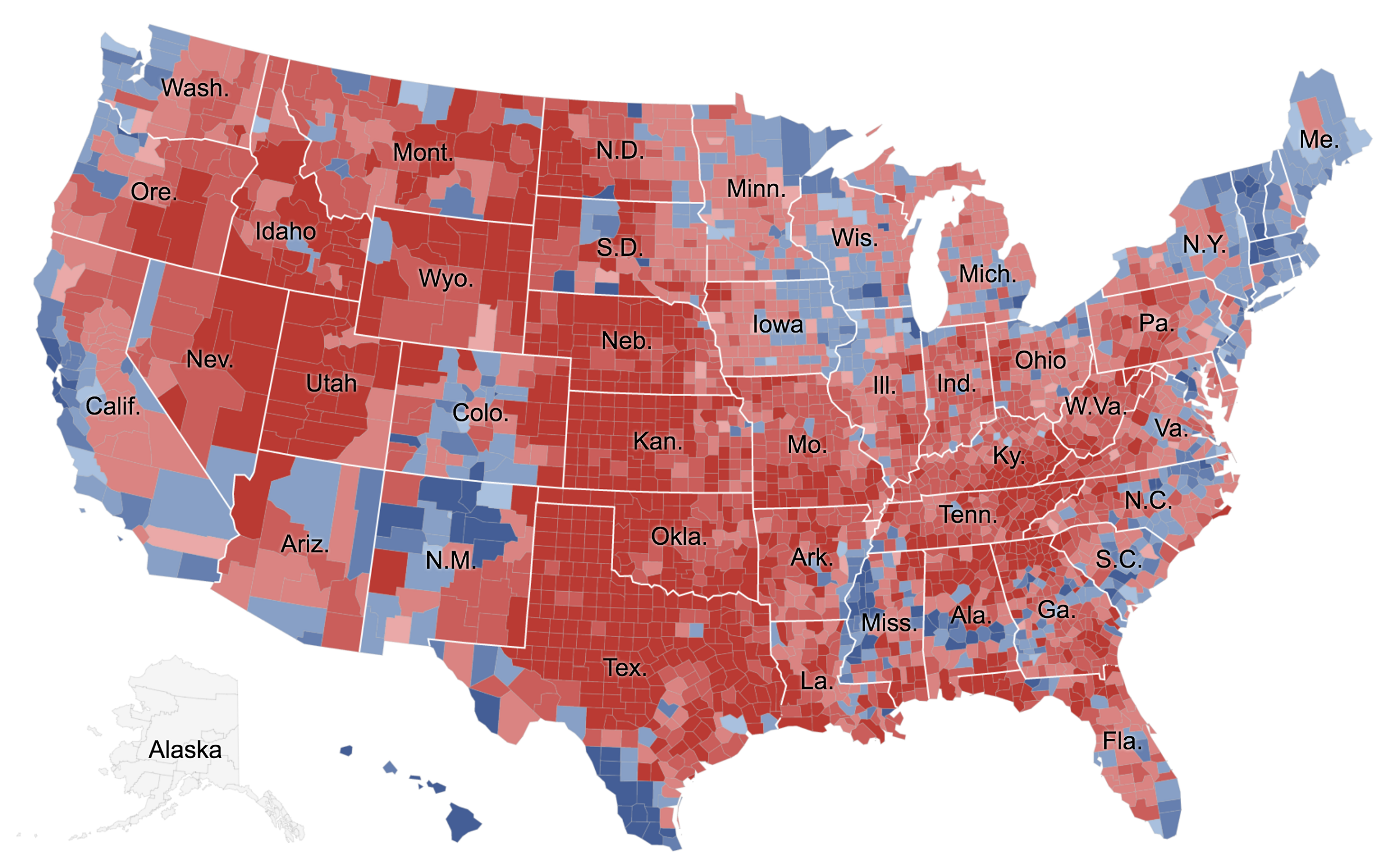
1. U.S Election Map:

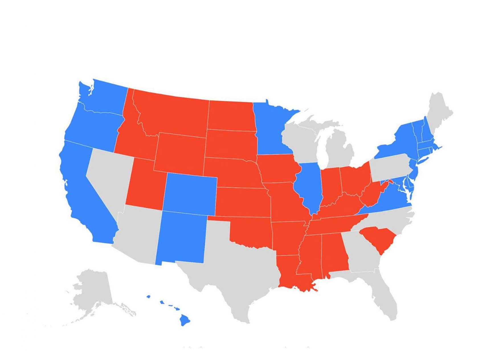
2. U.S Election Map State-wise:
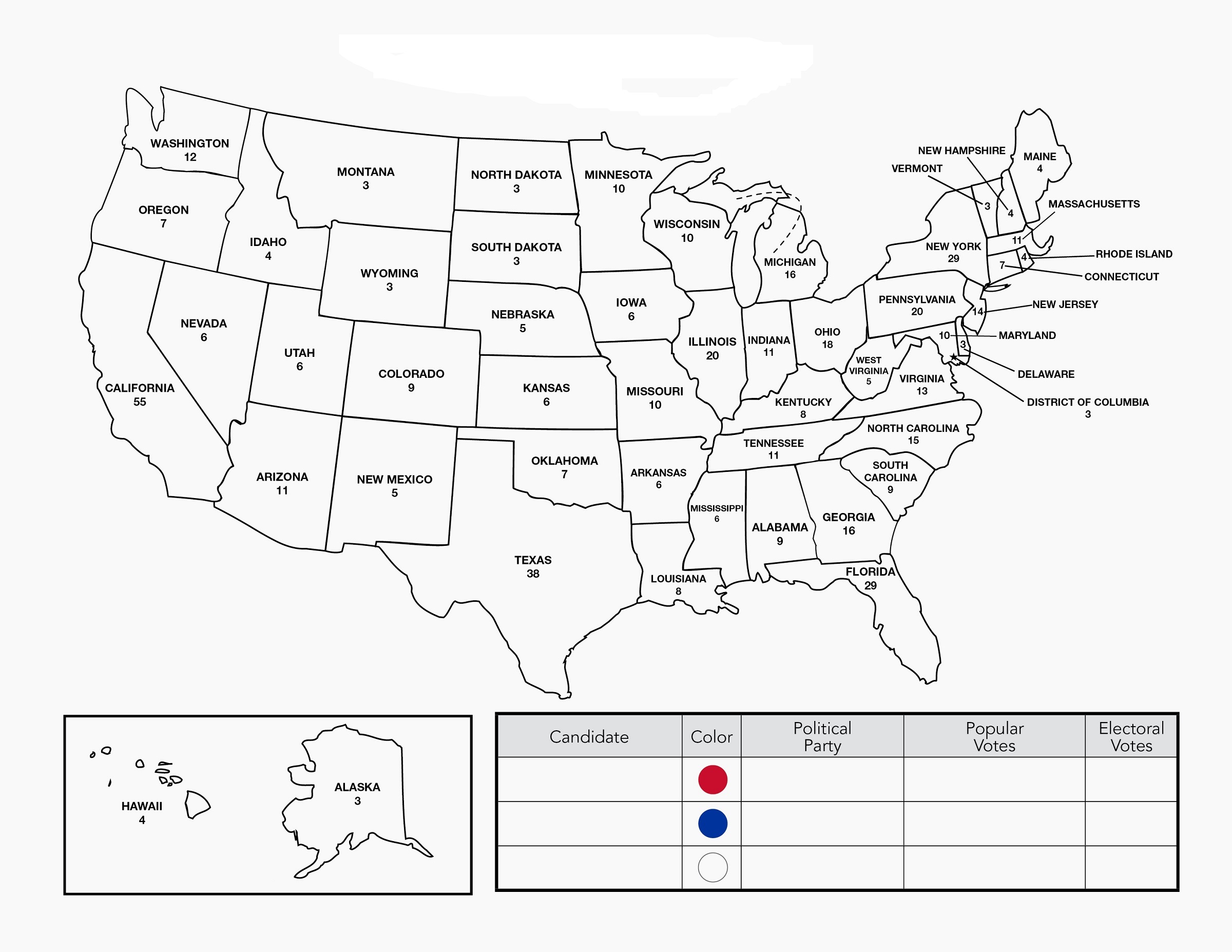
3. Blank US Election Map:
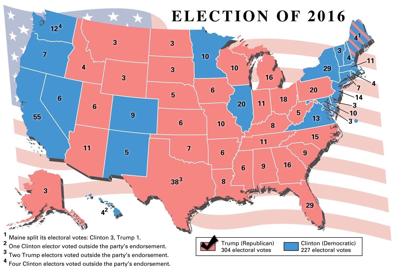
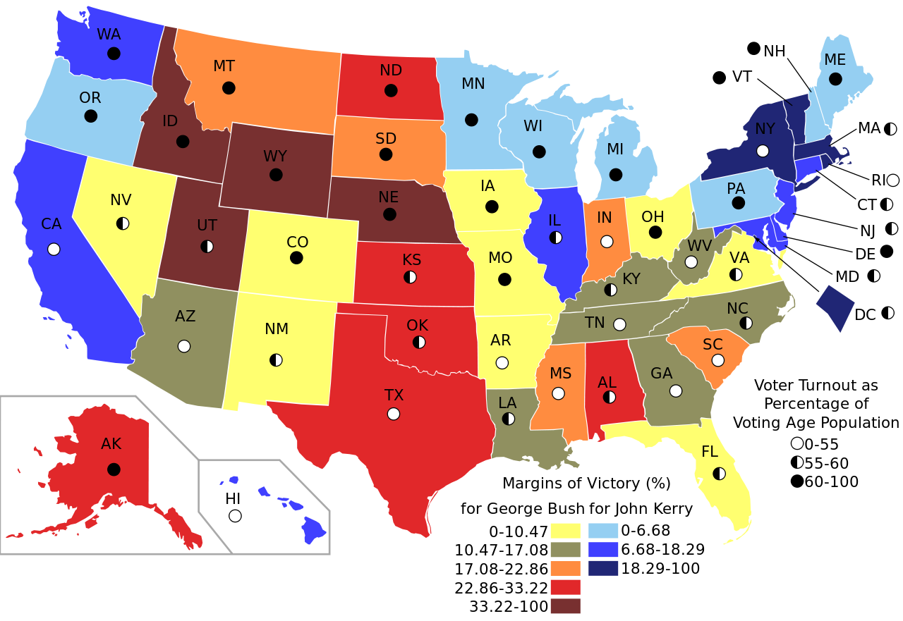
4. U.S Election Map 2016 :
5. U.S Election White Map:
6. U.S Election Map by County:
7. Printable US Election Map:
8. Election Map US:

We have defined 8 types of American election map above for you. With the help of this, you can get all the information about the election. For your information, we want to tell you that the Presidential election was held in the United States of America on November 3, 2020. Which was the 59th presidential election was between Biden and Donald Trump.
We have used two colors in all our election maps of the US. By which you will know about the election of Biden and Donald Trump. The blue color shows the results of Joe Biden, and the other red shows the results of Donald Trump. Through these two colors, you will be able to know the maps better.
The 2020 US Presidential Election was held on November 3, 2020 — the 59th presidential election. Joe Biden and Kamala Harris defeated Donald Trump and Mike Pence, winning 306 electoral votes to Trump’s 232.
The most recent 2024 US Presidential Election was won by Donald Trump, who defeated Kamala Harris to become the 47th President of the United States.
For your information, we have also included the old election 2016 maps in our list so that you can know about the past statistics. How was the last election? We have placed it at number 4 on our list. Which you can do regarding the election, for your research or in applying the idea of the next election?
They can see our 2nd image. Which we have shown state-wise election. A white election map has been kept in your list which you can use for your prediction. All these maps are printable and downloadable. You can do both with one click.
All you have to do is click on the PDF button. Which is mentioned below all the election map of USA. After clicking, a new window will open from which you will be able to download or print the map. You can download them for free and store them on your smartphone or computer. That too without making any payment.
Frequently Asked Questions
Q1: What do the colors on a US election map mean?
On a standard US election map, red states indicate states won by the Republican candidate and blue states indicate states won by the Democratic candidate. States that are closely contested are sometimes shown in purple.
Q2: Who won the 2020 US Presidential Election?
Joe Biden won the 2020 US Presidential Election, defeating incumbent Donald Trump with 306 electoral votes to Trump’s 232. Biden was inaugurated as the 46th President on January 20, 2021.
Q3: Who won the 2024 US Presidential Election?
Donald Trump won the 2024 US Presidential Election, defeating Democratic candidate Kamala Harris. Trump was inaugurated as the 47th President on January 20, 2025.
Q4: Can I download these election maps for free?
Yes, all 8 election maps are completely free. Click the PDF button under any map to download it instantly.


