
Everyone knows where technology is talked about, the United States is remembered. Because the United States is at the top in terms of technology and electricity. They need the power to run their machines which comes from electricity. Today we are going to talk about the power grid. If you also want to know about this, then stay with us on this website. We have prepared a list of US power grid maps for you.
List of Power Grid Map United States :
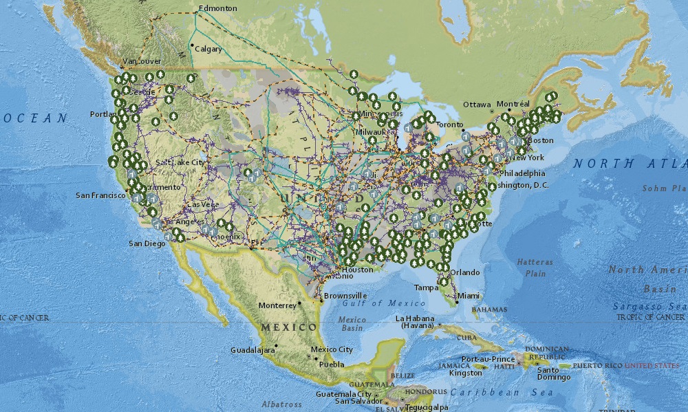
1. U.S Power Grid Map:

2. U.S Interactive Power Grid Map:
3. U.S Power Grid Synthetic Map:
4. U.S Blank Power Grid Map:

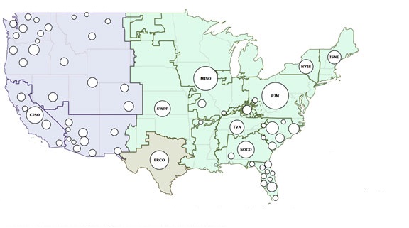
5. Power Grid Map USA :
6. U.S Power Grid Electric Map:

7. Printable US Power Grid Map:

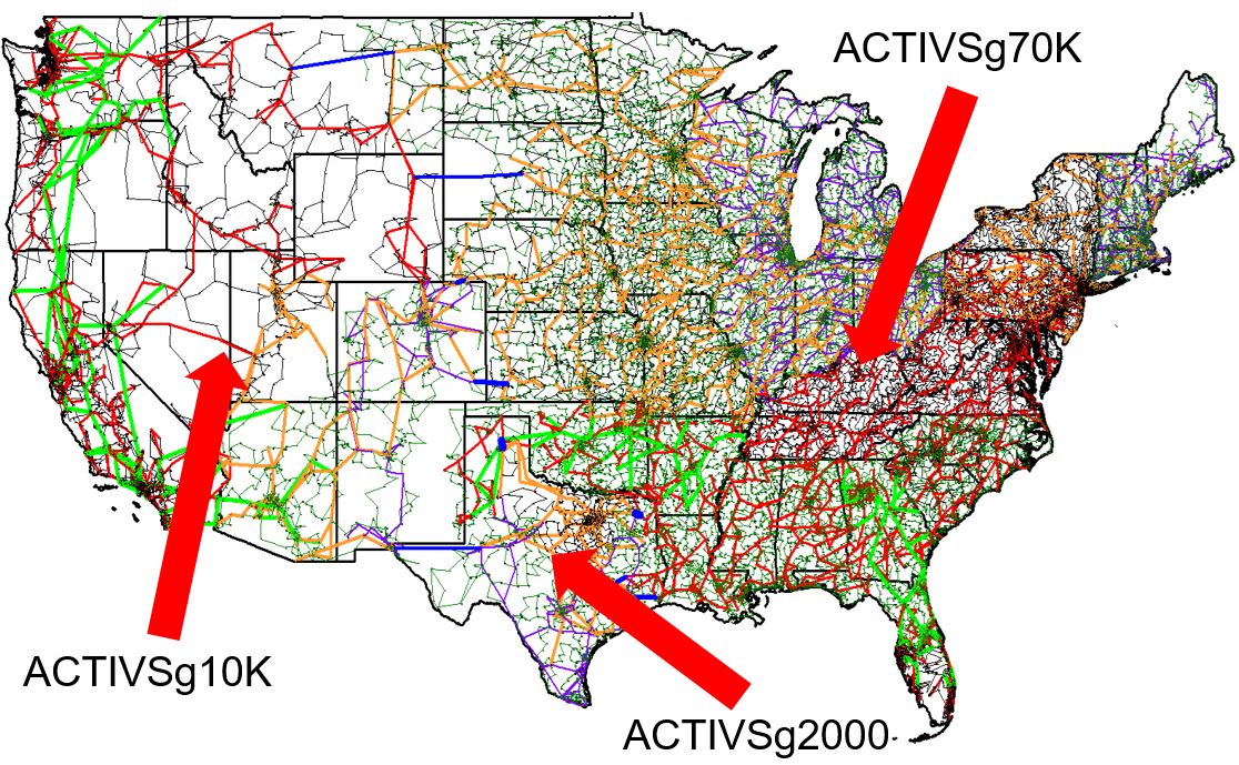
8. U.S Power Grid Regions Map:
9. U.S Power Grid Residential Map:
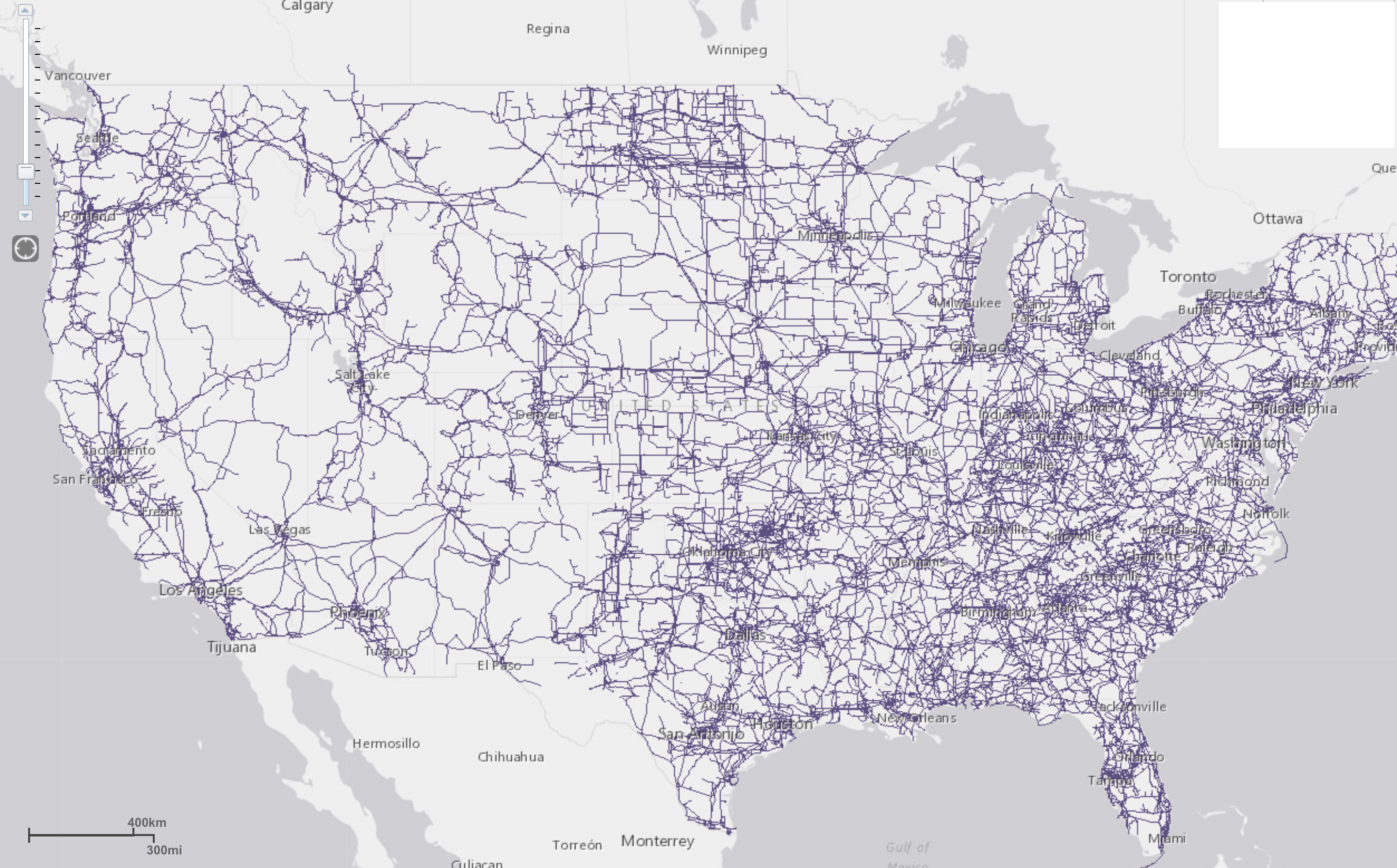
10. U.S Power Grid Route Map:
We have shown the above 10 methods map of US power grid. With which you can know about all the power sources of the country. For your information, we would like to tell you that the power grid is a connection of wires and cables made for the supply of electricity and electricity in an area. Through which electricity is delivered to the homes of the people.
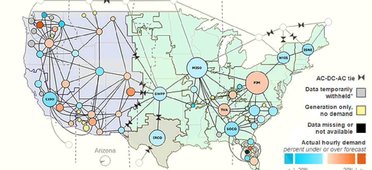
These power grids were divided into 3 different parts. As you can see in image 4. These three major 3 grids are located in the Western, Eastern, and Texas Regions. The power grid is a combination of a variety of equipment and technologies that deliver electricity to people through transmission lines and towers, individual consumer distribution lines, and generator stations. Through which they can operate their equipment easily.
Our power grid map US will prove to be very beneficial for you to be able to locate off-grid locations or do projects related to it. We have shown different types of American power grid maps in our list, which will make it easier for you to understand. The image related to their route is shown at number 10.
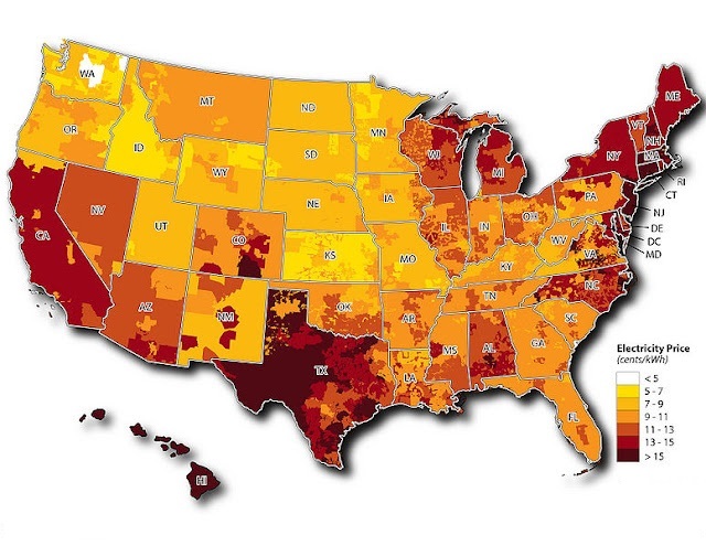
And to generate all these power grids, the 1st and 5th images will be best for you so that you can know everything related to electricity. If you are planning to shift somewhere else, then this article will be best for you. By which you will get information related to electricity. Because everyone knows very well that no equipment can be operated without electricity.
The 3 Major US Power Grid Regions
As shown in Map #8 above, the United States power grid is divided into 3 interconnected
systems:
1. Eastern Interconnection
The largest grid covers the eastern two-thirds of the continental USA, including all states east of the Rocky Mountains. It serves over 70% of the US population and connects to parts of Canada.
2. Western Interconnection
Covers the western US states, including California, Oregon, Washington, Nevada, Arizona, Utah, Colorado, and parts of Canada and Mexico. Known for its growing share of solar and wind energy.
3. Texas Interconnection (ERCOT)
Texas operates its own independent power grid, managed by the Electric Reliability Council of Texas (ERCOT). This was a major topic during the February 2021 winter storm when Texas experienced widespread power outages.
Key Facts:
– The US power grid has over 600,000 miles of transmission lines
– Over 7,300 power plants generate electricity
– The grid connects 145 million customers
Electricity makes a very important contribution to the lives of people. All these power grid maps of the United States are absolutely free for you. You do not need to pay any kind of payment to download these maps. All you have to do is click on the PDF button to download. Which we all have indicated at the bottom of the image. All these power grid maps of the USA are printable. You can also take their printout through the printer.
Frequently Asked Questions
Q1: How many power grids does the USA have?
The United States has 3 major power grid interconnections — the Eastern Interconnection, the Western Interconnection, and the Texas Interconnection (ERCOT). Texas operates independently from the other two grids.
Q2: Why does Texas have its own power grid?
Texas has its own power grid managed by ERCOT to avoid federal regulation from the Federal Energy Regulatory Commission (FERC). This became a major controversy during the February 2021 winter storm when the Texas grid failed and millions lost power for days.
Q3: How long are the US power transmission lines?
The US power grid has over 600,000 miles of high-voltage transmission lines connecting power plants to homes and businesses across all 50 states.
Q4: Can I download these power grid maps for free?
Yes, all 10 maps are completely free. Click the PDF button under any map to download it.


