
Blank maps are mostly used in schools, as no place names are mentioned on them. By which children can download those blank maps and fill in the state name, by doing this they will remember the state name. Below you are seeing the blank US Maps that which you can only use for practice purposes. Here we have added ten types of blank maps for you. Which you can choose according to your purpose.
Blank Map of America List :
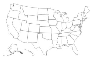
1. Blank U.S states Map:

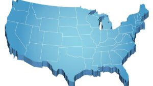
2. Blank U.S Map without Boundaries:

3. Blank Outline Map of the United States:

4. Blank U.S.A 50 states Map:
5. Blank U.S Map printable :
6. Blank Map of Southeast United States:

7. Blank Map of Eastern United States:
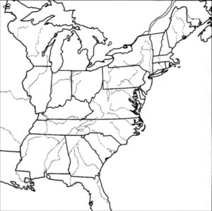
8. Blank Map of Northeast United States:

9. Blank Map of Western United States:

10.Blank Outline color Map of the United States:
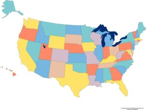
We have shown above a blank map of the 50 USA states that children in the primary class can use to color in an empty US map. They mostly use a blank map with Boundaries so they can easily to fill in all kinds of colors. He can convert this blank map into a colorful map, and our maps will help you complete your school project. We have a blank outline map. Some dotted lines are shown in this map, which shows the boundaries of the states very clearly.
We have shown a blank US states map printable from our side, which you can easily download. In this color map, you can fill in the states of the U.S.A. We have done this so that your time is not wasted in filling in the blank map. Many times, we have seen the teacher take our test, whether we remember the state name or not. By using this empty map, they get to know. How much have we practiced on these blank US state maps?
Some people sometimes need a map related to a specific area. We have a solution for your problem because we have a Blank Map of Southeast United States, a Blank Map of Eastern United States, a Blank Map of Northeast United States, a Blank Map of Western United States is shown in the list. These are some specific regions of the United States of America. You can use it according to you.
You will need these maps if you want to improve your knowledge or complete your projects. You can easily download these blank maps. You will see a PDF button at the bottom of the map, clicking on it will open a new tab in front of you. With its help, you can easily download the picture of a blank US Map PDF format. If you want to print then you will get a print option on the side of the download, from there you can print these empty maps of the USA.
On other websites, you will have to pay for these maps. But you don’t need to pay for these maps on our website. You have to download the map by going to the PDF button. Use all these blank maps for your test and practice purposes, and let us know how your experience was in the comments section. Apart from this, if you have any other problem related to your maps, then definitely tell us, your problem will be solved as soon as possible.
Frequently Asked Questions (FAQ)
Q1: What is a blank map of the USA used for?
A blank map of the USA is used by students to practice labeling all 50 states, by teachers for geography tests, and by researchers for marking data on specific regions. It is one of the most commonly used educational tools in US geography classes.
Q2: Which blank US map is best for kids?
Map #4 (Blank 50 States Map) and Map #10 (Blank Outline Color Map) are best for kids. Map #10 already has color-coded state boundaries making it easier for younger students to fill in names.
Q3: Is there a blank US map with state borders?
Yes. Map #1 (Blank US States Map) shows all state borders clearly without any labels, making it perfect for geography practice and school tests.
Q4: Can I print these blank USA maps for free?
Yes, all 10 blank maps are completely free. Click the PDF button under any map and use the print option directly from your browser.


